Carolina Excursions: Part 1
October 2000 - September 2002
In June of 2000, I moved to Winston-Salem, North Carolina, for my first job. Though my first job didn't last more than seven months long, I stayed in Triad. And during that time, I took advantage of doing a few excursions. These trips are in chronological order and range from national parks to simple events. Think of it as a diary during my stay in Winston-Salem and Enjoy!
Old Salem
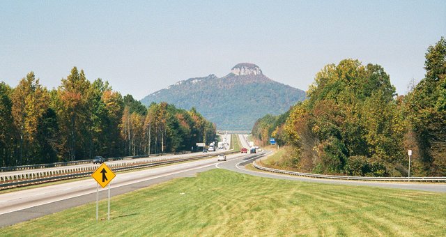
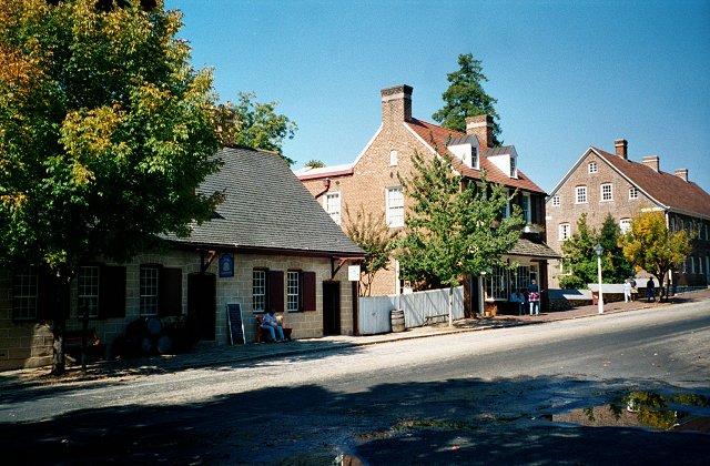
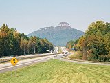
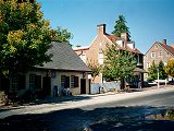
Not really much to say, this was a short drive on October 16, 2000. I first drove up to the scinic overlook on U.S. 52 that offers one of the best views of Pilot Mountain. Later that day I went to Old Salem, which is off exit 108C on US 52/NC 8. A quick history of Salem, it was founded in 1766 by Moravians (German Settlers from Pennsylvania). Later in 1849, the county of Forsyth was founded and the Salem Church leaders sold 50 acres of land just north of Salem which became the county seat called Winston. Then in 1913, the towns Winston and Salem merged to become known today as Winston-Salem.
The Salem of today is now an historic community where they practice arts and crafts from days long ago. Several old-style houses line-up the cobble streets and at the center is Salem College, which is the 13th-oldest college in the nation and the oldest dedicated to the education of women. I personally didn't do a whole lot while I was there other than take a few pictures of the place.
Pilot Mountain
|

Salem College
|
Old Salem
|
Welcome
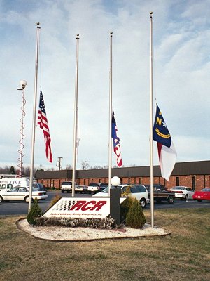
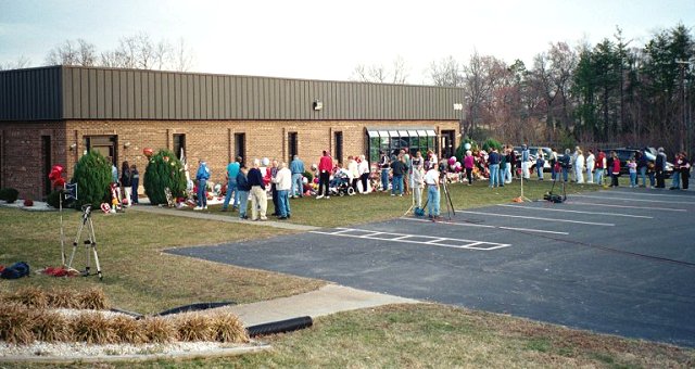
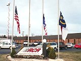
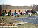
On February 21, 2001, I took a trip south of Winston-Salem to the small community of Welcome. This day however was a sad day for one of NASCAR's racing legends, Dale Earnhardt, recently died at the Daytona 500. Many people from all over the south was litterly in mourning and they flocked to places like the Richard Childress Racing Museum, located in Welcome. This was a major event (Including up to the minute news broadcast from all local television stations), so I too joined the Millions to pay my respect to the racing legend.
Richard Childress Racing Museum
|

Shrine of flowers for Earnhardt
|
People Mourning
|
|
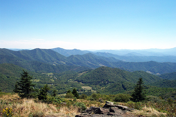
Sauratown Mountains
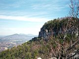
On the 27th of February, I took a trip up to Pilot Mountain again, but this time I took some pictures from inside the State Park. Part of the ancient Sauratown Mountains, it was once known as Jomeokee by the Saura Indians, which means "Great Guide" or "Pilot." Pilot Mountain is capped by two prominent pinnacles. Big Pinnacle, with walls of bare rock and topped by vegetation, rises 1,400 ft. above the valley floor. Connected to Big Pinnacle is Little Pinnacle (duh!), which is where visitors go on top of to view Big Pinnacle and the surrounding area. Though there are several trails inside Pilot Mountain, going on top of Big Pinnacle is not permitted since it is considered too dangerous for most people to challenge.
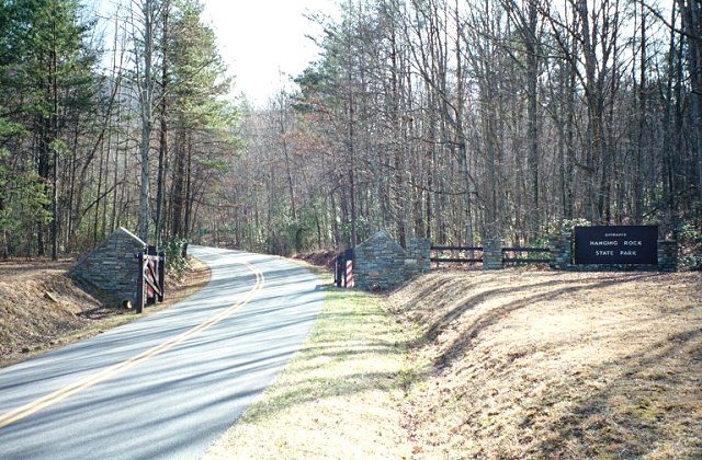
A few days later, March 1st, I traveled to Hanging Rock State Park in Stokes County. Also part of the once mighty Sauratown Mountains, it features a lot of things for the outdoors type (which I'm not). I wasn't able to get any good picture of the mountain itself (known for it's sheer cliffs and bare rock), but I did get to experience some of its trails and got a picture of one of the small waterfalls that come off this mountain. Also, some of the roads getting there (like NC 66) are more amusing than your typical roadways in the Piedmont.
|

Pilot Mountain State Park
Sauratown Mountains
|

Pilot Mtn. (Big Pinnacle/2,440 ft)
|
Hanging Rock State Park
|

Hidden Falls
|
|
The Battle of Alamance & Guilford Courthouse
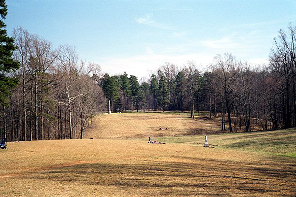
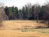
On March 11th, 2001, I was driving back from Raleigh (visiting my sister) when I decided to take a short detour. The first side trip was to the Battle of Alamance near Burlington, which is basically just a field, a granite monument and a small old house nearby. The flag poles represented where the Royal Governor's Milita and the Regulators (rebel farmers) were lined up during their battle on May 16th, 1771. The Regulators were defeated, but still remembered as another important step before the Revolutionary War.
The second detour was to the Guilford Courthouse National Military Park in Greensboro. This was the site where on March 15, 1781, British General Lord Charles Cornwallis battled against American Major General Nathanael Greene for the prize of Guilford Courthouse, a small shack in the North Carolina backwoods. Even though the British won this battle, they took heavy casualities, as they marched onward towards Yorktown, Virginia. Today, the park perserves the 220-acre heart of the battle, 28 monuments, and the graves of William Hooper and John Penn, two of North Carolina�s signers of the Declaration of Independence.
|

Alamance Monument
Guilford Field of Battle
|
|
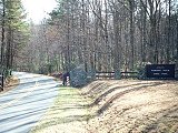
Mount Mitchell
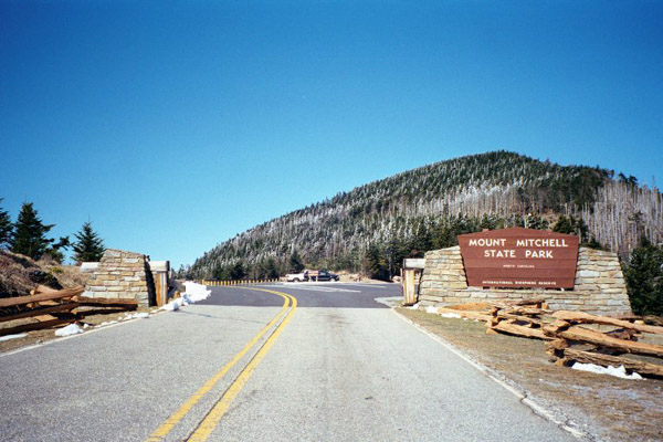
On March 18th, 2001, I took a little mountain drive, which lead me to Mount Mitchell State Park. Named after Dr. Elisha Mitchell, a professor at the University of North Carolina. He first measured the height in 1835. In 1857, Dr. Mitchell set out to verify his measurement of the peak and perished at the foot of a waterfall on the mountain slope. Today, we all know that Mount Mitchell towers at 6,684 feet, making it the highest mountain east of the Mississippi.
Something that most people probably don't know is that Mount Mitchell is part of the Black Mountain Ridge, merely 15 miles long, from Yeates Knob and Celo Knob. Though short in length, it features six of the ten highest mountain peaks in the eastern United States.
The day I drove up there, their was still some snow on the ground and in the trees, though it wasn't that cold. At the top is the tower, where you can view all of North Carolina at its splender. Nothing else to say really, other than it was a neat place to visit.
|
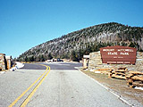
Entrence to the State Park
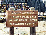
Sign & Tower
|
Charlotte Colosseum: Hornets vs. 76'ers
It has been awhile since I've been to a NBA game, so this was a nice treat. With a few courtside tickets, compliments of Coca-Cola, me and my friend, Joe, went off to the Hive on January 17th, 2002 to see the Charlotte Hornets play the Philadelphia 76'ers. Though the Hornets lost to the 76'ers, 93-88, they were still great seats and had a good time.

Da B-Ball Game
|

Courtside at the Game!
|

Air Hugo
|
Linville Falls
On a somewhat mild February weekend, I went back to my Parents house again (something I typically do at least once a month) up on Sugar Mountain. That Saturday, February 9th, I drove down to one of the local tourists destinations on the Blue Ridge Parkway known as Linville Falls. I've been to Linville Falls countless times, but this is the first time I actually brought a camera along... and not just any camera, but my new Kodak Digital Camera. You could say it was a field test, regardless it was an excuse to get out of the house.
|
Going down NC 181 and then via NC 183 (this is a good shortcut, don't ever use the BRP if your in a hurry), I arrived in the small community of Linville Falls. Nestled on the county lines of three counties (Avery, McDowell, and Burke), it doens't have much to offer except good Bar-b-que, a 19th Century U.S. Post Office (Still Active), and a waterfall of the same name. Sadly, because I decided to visit the falls so late in the afternoon, I only had enough sunlight left to go on one of the trails to the falls. So I picked a trail I never went on before that would put me in the bottom of the Gorge. This wasn't an easy trail either, as you were either climbing up or down the mountain, not to mention that I was the only person on this trail this late in the day. But I braved it and got some nice pictures of the scenery, and even put my hands in the freezing water (I didn't drink the water though, I have heard that it is somewhat polluted... so sad). Too sum up the rest, I made it back to the visitor center as the sun set.
|
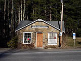
Linville Falls Post Office
|

Linville Gorge Trail
|
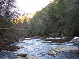
Linville River
|

Linville Falls
|
|
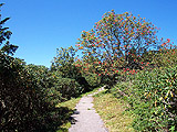
Roan Mountain
On a nice and sunny day in September, I decided to take a sudden trip to Roan Mountain. Originally, I always thought it was in Tennessee since that is where the community of Roan Mountain is located as well as the state park. However, after driving past both places along Tenn. Hwy 143, I soon discovered it was actually mostly inside North Carolina. At a location known as Carver's Gap (5,512 ft.), this is where Tennessee and North Carolina meet, the Pisgah and Cherokee National Forests meet, as well as the Appalachian Trail. Roan Mountain is also managed by the USDA Forest Service from Burnsville, NC.
Roan Mountain is actually not one mountain, but a five mile long ridge. The lowest point is Carver's Gap, while the highest point is Roan High Knob (6,286 ft). On the other side of Carver's Gap are several bald mountains, named because the tops are grassy instead being covered by trees and shrubs. Roan Mountain biggest feature is the Catawba Rhododendron Gardens, which peaks in June. Thanks to this excursion, I saw some breathtaking views, got some exercise, and a little sunburn.
|
Garden Trail

View from Roan High Knob
|

Another Scenic View
|

Roan Mountain
|

Lonely Mountain Road
|
Back to my Homepage
|